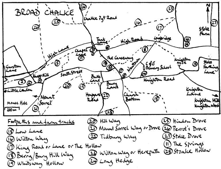
Broad Chalke Map
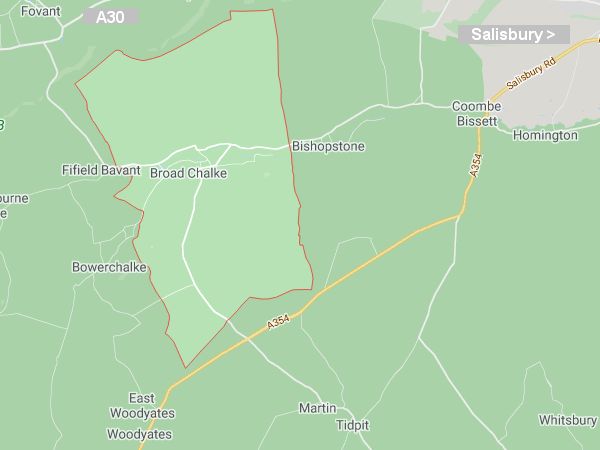
Area Map of Broad Chalke
Road Map
(showing currently used but sometimes unofficial or incorrect road names)
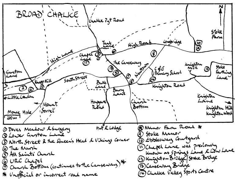
Historical Road Names
Note that from a historical perspective, some of the road names above and postcodes below (which have been used in Google Maps, bt.com addresses, local government documents and many other places) are incorrect, and merely the result of recent common useage.
- Howgare Road (or Hogger Road): Google used to mark Howgare Road as running from Longbridge to Bury Lane (incorrect) and from Bulls Lane to Martin Drove End on the A354 (partly incorrect), but corrected this in April 2012. Howgare Road runs from the junction of Bulls Lane and Bury Lane to the Oxdrove at the top of the hill, not as far as the A354. Wiltshire Council are now using Google names on their planning notices, so may change to the new names but the old planning notices will remain with the wrong road name.
- Manor Farm Road: There is no such thoroughfare as "Manor Farm Road". The road that runs from Longbridge to Bury Lane is called Smockland Way - this is clear from 1792, but no one has used this name for many years and Manor Farm Road has been used incorrectly. Many houses and the primary school use Newtown in the address instead of the road name because Newtown is the official place name for the area either side of the road.
- Church Bottom: This unmade farm track only runs south from the staggered cross roads ie from its junction with Smockland Way. More research is required as to the name of the short stretch of road between that junction and the South Street/Causeway bend. It may be the continuation of South Street, or may not have a name at all. Manor Farm and other dwellings on this short stretch of road should not be stated as on Church Bottom although they are listed as such in addresses including bt.com online addresses and have a Church Bottom postcode.
- Chapel Lane: This was often called Springs Lane in the recent past (it has lots of vigorous springs in February and March and often floods) and it was called Low Lane centuries ago when it was a route to Fifield Bavant, Ebbesbourne Wake and Shaftesbury. High Lane replaced it, probably due to the water problems. Chapel Lane is now the official name.
- High Lane was also called Shaftesbury Road in a letter to H G Blick dated 16/07/1963 (URC records in the Broad Chalke Archive).
- North Street: This road continues round Vikings Corner to the Queen's Head and the junction with High Road and The Causeway. In the Trust Deed for the Congregational Church (now the URC Chapel) dated 15th December 1862 the street outside the Chapel is called North Street, but it is now considered that Ivon House and the Chapel are in High Road and the Queen's Head is in North Street.
Postcodes
- SP5 5DE Newtown
- SP5 5DH South Street
- SP5 5DJ Bulls Lane
- SP5 5DN South Street
- SP5 5DP Bury Lane
- SP5 5DQ South Street
- SP5 5DR Howgare Road
- SP5 5DS Newtown / Manor Farm Road / Church Bottom
- SP5 5DT Newtown/Manor Farm Road
- SP5 5DU Knighton Road
- SP5 5DW Church Bottom
- SP5 5DX Knighton Road/Knighton Lane
- SP5 5DY Knighton
- SP5 5DZ Knighton Hill/Knighton Wood
- SP5 5EA Knighton
- SP5 5EB Knighton
- SP5 5ED Stoke Farthing Lane
- SP5 5EE Stoke Farthing Courtyard
- SP5 5EF Stoke Farthing/High Road
- SP5 5EH High Road
- SP5 5EJ High Road/The Causeway
- SP5 5EL Doves Meadow
- SP5 5EN North Street/Chapel Lane
- SP5 5EP Tank Lane
- SP5 5EQ High Road
- SP5 5ES Chalke Pyt Road
- SP5 5ET Chalke Pyt Road
- SP5 5EX High Lane
- SP5 5EY High Lane
- SP5 5HA High Lane
- SP5 5HB Knighton
- SP5 5HH High Lane/The Marsh
- SP5 5HJ The Marsh
- SP5 5HL Little London
- SP5 5HN Lower Gurston Lane
- SP5 5HP High Lane
- SP5 5HQ Mount Sorrel
- SP5 5HR Gurston Lane
- SP5 5HS Gurston Lane
- SP5 5HW Lower Gurston Lane / Knapp Hill
- SP5 5HX Knighton Road
- SP5 5LU Hut & Lodge
- SP5 5LX Hut & Lodge
- SP5 5QH South Street
Footpaths and farm tracks